PMRDA’s GIS Portal Ready; All Planning-Related Information Now Just a Click Away!
Details regarding the Ring Road, Metro routes, flood lines, and village boundaries are now accessible from the comfort of home; no more repeated trips to the office for citizens!
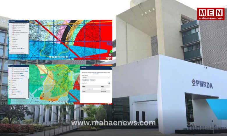
Pune: The Pune Metropolitan Region Development Authority (PMRDA) has developed a GIS (Geographic Information System)-based public portal to provide planning-related information to citizens, investors, developers, architects, engineers, and various government departments in an accessible, transparent, and digital format. This digital facility enables citizens to access all primary regional planning information in one place, right from their homes.
Follow MahaENews-X on: Follow MahaENews on Instagram
The public GIS portal provides data on the PMRDA jurisdiction boundaries, the sanctioned Regional Plan (RP), proposed Town Planning (TP) schemes, village boundaries, and the limits of municipal corporations and councils. Additionally, it includes infrastructure layers such as the MSRDC and PMRDA Ring Roads, Pune Metro routes, railway lines, Public Works Department (PWD) classified roads, and Transit-Oriented Development (TOD) zones around Metro stations. Information regarding environmental and safety aspects—such as the Irrigation Department’s red and blue flood lines; boundaries of wildlife sanctuaries, hill stations, and townships; and buffer zones for the NDA, HEMRL, MADC (Purandar Airport), and other defense establishments—is also being made available on the portal in a phased manner.
Thanks to this portal, citizens will no longer need to make repeated visits to the PMRDA office to obtain planning details regarding specific plots or properties. This will save time and money while reducing the stress associated with administrative follow-ups. Furthermore, developers, architects, and engineers will gain easy access to the essential preliminary information required for preparing development proposals. This digital platform will enhance transparency in the planning process and facilitate better coordination of data across various government departments. The primary objective of this initiative is to boost ‘Digital Governance’ through modern technology and enable data-driven decision-making for sustainable development.
“This GIS-based public portal marks a significant step towards making the planning and development processes within the PMRDA’s jurisdiction more transparent, efficient, and citizen-centric. Citizens will now be able to access official preliminary information regarding roads, flood lines, metro routes, and regional planning in the vicinity of their plots—all with a single click from the comfort of their homes. This will save citizens’ time and reduce the need for multiple visits to the PMRDA office. PMRDA is committed to providing transparent and accessible administration by promoting ‘Digital Governance’.”
“This GIS-based public portal marks a significant step towards making the planning and development processes within the PMRDA’s jurisdiction more transparent, efficient, and citizen-centric. Citizens will now be able to access official preliminary information regarding roads, flood lines, metro routes, and regional planning in the vicinity of their plots—all with a single click from the comfort of their homes. This will save citizens’ time and reduce the need for multiple visits to the PMRDA office. PMRDA is committed to providing transparent and accessible administration by promoting ‘Digital Governance’.”
— Dr. Abhijit Chaudhari, Metropolitan Commissioner, PMRDA